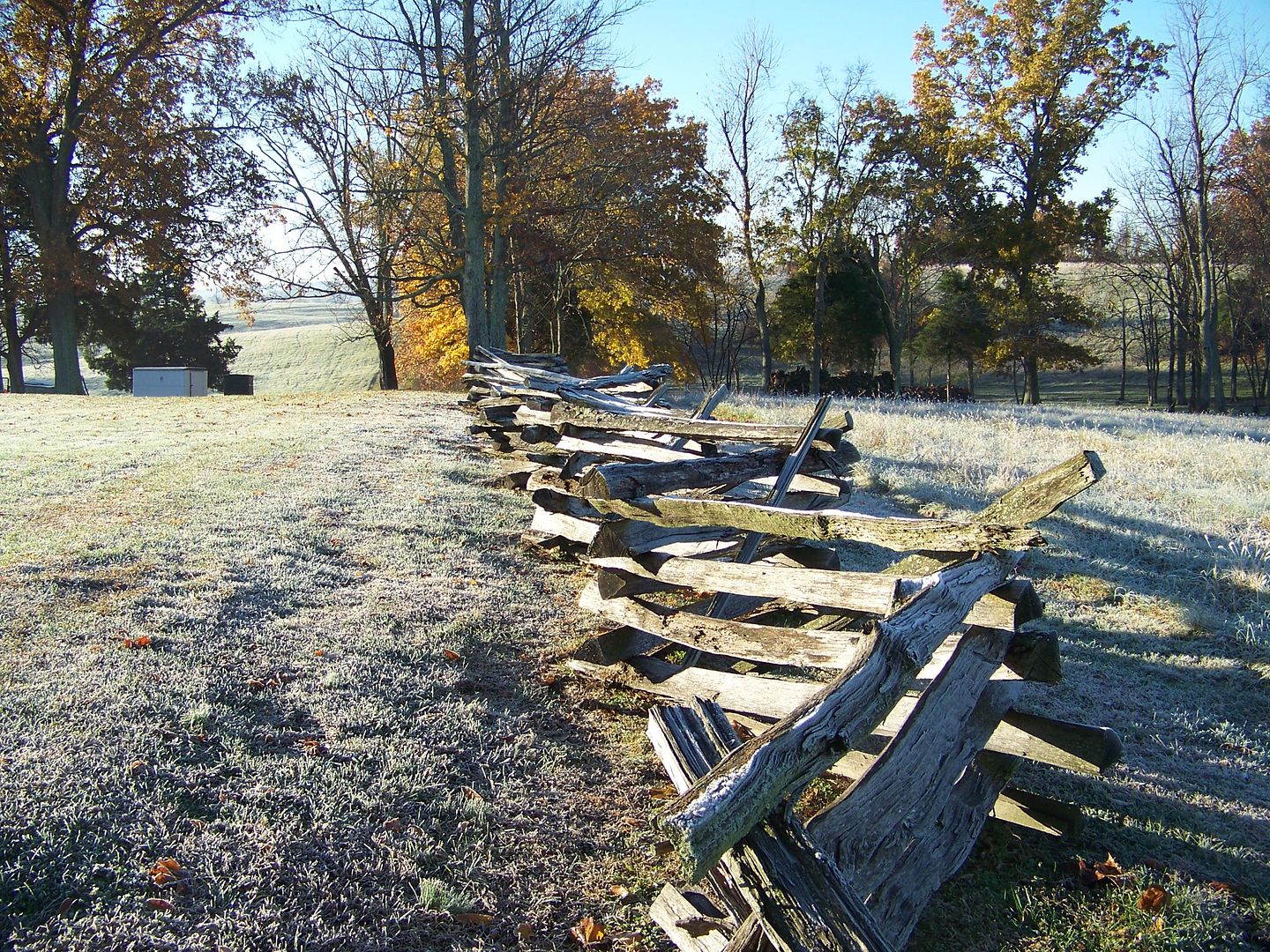
Showing posts with label Civil War Preservation Trust. Show all posts

Tuesday, December 4, 2012

Preservation Success at Perryville

I found this article on facebook and shared it there and thought it was worth posting here. It's great that more land is being preserved and hopefully that continues.

I'm already trying to think of my 2013 trip or trips to the site, perhaps around Memorial Day Weekend, with side trips to Bardstown, Hodgenville or other local places of historical interest.

Perryville Preservation

Union re-enactors at Perryville's 150th, October 6 & 7 2012

Monday, February 13, 2012

More Preservation efforts at Perryville

Here is the Civil War Trust's newest announcement about its efforts to save more land at Perryville. This time, 121 acres, featuring land known as the "Slaughter Pen," the scene of some extremely tough fighting.

Here is an image of the orginazation's map of the battlefield. More information can be found at their website, Civil War Trust Perryville information

It is truly a beautiful battlefield and I wish the current preservation efforts nothing but success.


Sunday, November 6, 2011

Perryville Hike Thoughts and Pictures


As I mentioned previously, I really enjoyed my trip to Perryville. It is a beautiful spot and I again thank Darryl Smith of Ohio at Perryville for leading the hike and providing such an outstanding tour of the sites we visited. His knowledge of the battle, the units involved and their movements, how they interacted and how the topography of the land affected them is top-notch and he did a fantastic job of telling the story of the battle in an understandable and informative way. If anybody gets the chance to participate in one of his future hikes, I gladly recommend it and hope to be there again myself. I also hope readers may consider donating to the Civil War Trust's efforts to purchase 141 more acres of this battlefield.


I had never been to Perryville this late in the year, or so early in the morning. (I arrived about 9:15, the day before time "fell back") Seeing the ground and area covered in frost was a new experience for me and it was beautiful, especially in the very bright early-morning sunshine. I'm not sure these do justice to the view I saw while standing there, but I am posting some of the pictures I took. (To see all of the 150+ pictures I took, please see my photobucket album. I have not added descriptions to the pictures. I did take a lot of shots of cannon and fences, but plenty of the ground itself too.)


I wish I could have captured the whole feeling I experienced when I got there - the birds singing and chirping, including a few "bob-whites,"  a dog barking somewhere in the distance, its bark echoing in the hills,  the sound of dew dropping from leaf to leaf on a big sycamore tree, or the occasional brown, broad leaf floating in the wind while falling from that same tree. I cannot imagine nature producing many more ideal, serene and peaceful scenes than it did yesterday morning. That this all occurred over what had been the scene of such fighting and killing was something I did not realize or appreciate at the time, but now think about in wonder of that irony.  I was truly blessed to experience such a fine morning.


Leaves falling from Sycamore tree

One point I had not considered before, but that Darryl mentioned was that the topography of the battlefield could be confusing. Many who have read about Perryville have read about the "acoustic shadow" that supposedly kept Union General Don Carlos Buell from hearing the sounds of the fighting, but the visuals could cause some uncertainty too. In the below photo, the group of trees on the right is actually on a third ridge (picture taken from the first ridge.) There are another ridge and valley in between where I took the picture and those trees. This caused the Confederates some confusing in figuring out how to aim their guns. I'm sorry I did not take a better picture of it, but I guess I got too cute with getting the leaves in the foreground.


Here is a picture of the Bottom house, perhaps the most well-known part of the battlefield, even though the house and land around remain on private property, not part of the state park.


 Below are a few scenes that I liked.


A cannon and fences in the same picture - I could not resist.
Parson's Ridge (Open Knob) at the top of the hill   
Doctor's Creek - soldiers wished it was this full of water 149 years ago
It was a beautiful day


On the above photograph, you can see a hill in the immediate foreground, then another one in front of it, and a few more in the distance. This is an example of "rolling hills, " a phrase that is much easier to understand when you see (and walk) such hills.

Yet another hill to climb 
I'm not sure there is any way to explain the many ridges on this battlefield. Even the pictures cannot really do it justice - you have to walk it and see it for yourself. The hill in that final picture was much steeper and longer than it appears in the image (and came just after we had climbed up a previous long hill, away from the creek.)  The next-to-last photo sort of shows how it goes -hill, valley, hill, valley, etc. on and on.  Some of the hills, as in the bottom photo, were bigger than in this scene. Multiple times during the battle, the Confederates would chase Union forces off one hill, only to get to the top of that ridge and see the Federals reforming on yet another ridge-line in the distance. Rinse, lather, repeat.

Picture of the hikers, with Darryl Smith on the far left, leading the group
What a wonderful day and hike this was. I enjoyed it tremendously and hope to make a return trip to this hallowed ground again next year. I strongly encourage others to do the same.

Saturday, August 20, 2011

Save more land at Perryville

Civil War trust campaign

Here's a link to my report from my trip to Perryville last year. It's a beautiful, wonderful battlefield that I hope to visit again soon

Tuesday, January 4, 2011

Civil War Photographs in 3-D

In a previous entry, I mentioned the book Lincoln in 3-D and how I enjoyed viewing those pictures like that.

Well, the Civil War Preservation Trust's website has a few more 3-D pictures as well, with cooperation from the Center for Civil War Photography(CCWP). Some of them are in the book I mentioned, but for those who do not have the book, but have a good pair of 3-D glasses, it is worth the time to check these views out.

If you don't have such a pair of glasses, you can also order a pair free from CWPT. (I have ordered some, but the set I had in the book works for this site as well.


Civil War Photos in 3-D 

Or try this link to the CCWP page.

Friday, October 8, 2010

Remembering Perryville, link by link

Union Memorial

Today, October 8, 2010 is the 148th anniversary of the bloody, hard-fought battle of Perryville. On this date in 1862, thousands of men, on both sides, put forth tremendous efforts and showed incredible courage along the hills and valleys in Boyle County, Kentucky, and this post is in honor of them.
 
I acknowledge I've been "Perryville-centric" this week, but it seems only appropriate to recognize the ferocity and importance of this battle in the Western Theater today. I will not go into details about the actual battle on this post, but will share a few links to some sites that provide fascinating information about it and that describe it much better than I can.  I probably have shared some of these links before, but find them to be worth exploring again on this day.


(I do admit a "parochial" approach to my posting about this battle too - as a native Kentuckian, I do take some pride in having such an important battle fought on Bluegrass State soil, the largest one in this state. I certainly do enjoy studying how the Civil War had an impact in the area where I have lived my entire life and this blog will probably reflect that frequently. My interest in the war itself sprang from a childhood fascination that started when I learned Abraham Lincoln was born in the Commonwealth.)


Confederate Memorial

Though it often gets overshadowed by more famous fights at 2nd Bull Run and then Antietam, Perryville has also been viewed as the "Confederate High Water Mark of the West" though that moniker is also rooted in the Eastern Theater, attached originally to the fields at Gettysburg before the "of the West" extension was added.

First, here's a link to a previous post I made about the Battle of Richmond, with some other links to information about the early stages of the Confederate invasion of Kentucky, the campaign that culminated at Perryville.

This link from the Civil War Preservation Trust will lead to several good articles and informative stories on this battle.  I especially enjoy this interview  with Kenneth Noe. I found it to be very interesting, but the other stories and links on that site are terrific as well.

I really like the Battle of Perryville.com site. The battle chronology link in the column on the left is especially helpful in understanding how the battle unfolded over the course of that bloody day. I studied that quite a bit before my spring-time trip to the Perryville Battlefield State Park, but this entire site is a valuable reference.

Perryville Battefield.org is another fine site and reference, with more emphasis on the park in current times, such as current events and preservation, instead of just the actual battle itself.

I found some good pictures of the battle ground at a Civil War Album.com site, with good descriptions of what each scene shows.

Earlier this week, I made two entries about one of the the brave men who gave his all at Perryville, William Rufus Terrill   (see also the follow-up post ). Before researching those entries, I knew a little about Terrill, such as he had a brother on the Confederate side, but did not realize he was so young or that his decision to support the Union was so painful. His fistfight with Phil Sheridan was news to me too.

In late May of this year, I finally made another trip to this Boyle County land and recorded these thoughts about that day. I also posted some photos from my trip on photobucket, though I never did go back to caption them.

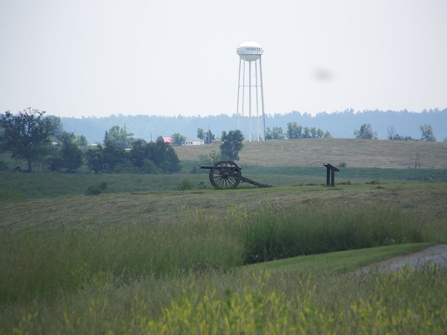
I especially find the below photo to be quite haunting in a hard-to-describe way. It does not exactly show a battlefield overrun by modern sprawl, but the water tower in the distance, staring down upon the cannon like a flying saucer in the sky, (or like one of these aliens from Star Trek the Next Generation )  certainly provides a sign of encroachment over the rolling hills of this beautiful battlefield. This structure certainly dominates the view of this section of hallowed ground.and  may hint at what could come in the future if the Commonwealth of Kentucky is not careful about its historic jewel.


You can visit the Friends of Perryville site to find more information on how to help support preservation of this ground, or, from a national perspective, theCivil War Preservation Trust is a wonderful organization to support as well.

I end with a couple appropriate lines from the Gettysburg Address that speak of the need to preserve and respect such land much better than I ever could.

we can not dedicate -- we can not consecrate -- we can not hallow -- this ground. The brave men, living and dead, who struggled here, have consecrated it, far above our poor power to add or detract... 
Amen to that.


Sunday, August 29, 2010

Battle of Richmond (Ky)

Fought on August 29 and 30, 148 years ago, the Battle of Richmond (Ky) , was a decisive victory for the Confederates and one of the best examples of a "rout" in the Civil War, especially in the Western Theater. Though it has not earned the fame of the Confederate victory at 2nd Bull Run (or 2nd Manassas, if you prefer), it was a key victory for the Confederates, getting their invasion into Kentucky off to a very positive start.  After this triumph, in which the men of Major General Kirby Smith bludgeoned the still inexperienced troops of  Major General William "Bull" Nelson, the Confederate hopes of securing Kentucky, and thousands of additional recruits, for their side seemed brighter than ever. Smith soon moved onto to major Kentucky cities such as Lexington and the state capital of Frankfort in the days after the success at Richmond, while Braxton Bragg's role in this invasion was just getting started.


(As an aside, Nelson, a very large man who was wounded and temporarily captured at Richmond, may be more well-known for his manner of death than for his generalship. He got into a dispute with Union Brigadier General Jefferson C. Davis at a hotel in Louisville a few weeks after the battle at Richmond. Davis confronted Nelson for what he considered to be an insult to his character, and Nelson then slapped Davis, who grabbed a pistol and shot Nelson. Davis had a powerful friend in Indiana Governor Oliver Morton, and escaped punishment for this act.)

William "Bull" Nelson, courtesy of blueandgraytrail.com


E. Kirby Smith, courtesy of sonofthsouth.net

While waiting for Bragg's army to reach Kentucky, Smith sent a division of his troops, perhaps 6,000-8,000 men total,  under the command of Brigadier General Henry Heth (of Gettysburg fame), to threaten Cincinnati, an important trade city located along the Ohio River, about 80 miles to the north of Lexington and 100 miles from Richmond. After several days in the region with no fighting other than than a couple of small skirmishes, Heth realized the region was heavily defended by earthworks along the hills of Northern Kentucky. Union general Lew Wallace, per orders of Department of the Ohio commander General Horatio Wright, rounded up thousands of troops and tens of thousands of local militia to man these defensive positions. When Heth saw the strength of these fortifications, and received orders from Smith to leave the region, he and his men returned south to rejoin Smith's men in central Kentucky, just a day or two before Bragg and his troops crossed into Kentucky. The threat to Cincinnati had dissipated, but Kentucky was still in the throes of invasion.

Here is an article that nicely summarizes what many people call "Bragg's invasion of Kentucky" though it seems to have been Smith's idea. With Smith being mostly inactive after the victory at Richmond, Bragg's army raced Don Carlos Buell's Union troops to reach Louisville first, a race that ended with the Battle of Perryville, the bloodiest battle fought in Kentucky. This hard-fought battle shifted most attention of the Kentucky campaign (when attention can be diverted from the Antietam campaign in the East) to Bragg, his decisions and his army.

Nevertheless, the battle at Richmond gave the Confederates one of their most decisive victories in the war and provided positive (though short-lived) momentum for them in the fall of 1862. Though that momentum waned as Smith waited for Bragg, and eventually disappeared completely following Bragg's post-Perryville retreat, this battle showed that the Confederates in the West could fight well and defeat their opponents, though general perception often is that the Union dominated in this theater. Perhaps they did, but the Rebel army was very capable of taking the upper hand at times. 

Here is a link to the map of the Battle of Richmond created by the Civil War Preservation Trust (CWPT), which earlier this year named Richmond to its list of 2010's most endangered battlefields .

Beside helping the CWPT, support for the Richmond Battlefield can be provided through the website of the Battle of Richmond Association as well.

I have never been to the Richmond battlefield, so I think that might be a good idea for a trip one day this fall.

Thursday, July 22, 2010

CWPT Campaign to save 782 acres at Brandy Station

Here's a link to the announcement at the Civil War Preservation Trust's website.

I received the following announcement (slightly different than at the webpage) about it today via email


Help Save the Brandy Station Battlefield

Save the land where Buford, Rooney Lee, Hampton, and Devin fought
A Can't-Miss Opportunity to Preserve 782 Battlefield Acres
What would you think if I told you that you could help save 782 acres of hallowed ground at the Brandy Station battlefield in Virginia for just $85.68 per acre?
Brandy Station
Help Save Franklin
In a world where CWPT often must pay about $5,000 - $10,000 or more per acre of hallowed ground I've got to tell you that a price of $85.68 per acre gets your attention!
The two parcels that make up this new preservation efforts are highly significant to the Battle of Brandy Station. The northernmost tract is where Gen. John Buford's Federal cavalry fought with Rooney Lee's Confederate troopers. The southern parcel includes land where Federal cavalry under Col. Thomas Devin repeatedly clashed with Confederates led by General Wade Hampton. As historian Bud Hall puts it, “there is no piece of Piedmont plain in Culpeper County that witnessed more infantry and cavalry action than this property.”
Brandy Station 2010 Preservation Campaign
  • Acres: 782 acres
  • CWPT Fundraising Goal: $67,000
  • Match: Roughly $116 to $1
  • Match Sources: Landowner donated conservation easements
For more: www.civilwar.org/brandystation10
New battle map, historian videos, history articles, and photos online!
In this very extraordinary case at Brandy Station, we have two landowners donating conservation easements on their land directly to the Commonwealth of Virginia.
What this means is that, in return for federal and state tax benefits based on the value of their property, these landowners have forsaken all future development rights to this land meaning, it will be protected just the way it is forever. The funds that CWPT are raising will pay for necessary closing costs, making sure the land is preserved.
Please let me hear back from you as soon as possible, and please accept my deepest thanks for your generosity.
Very sincerely yours,
Jim Lighthizer
Jim Lighthizer
President, CWPT

Tuesday, June 1, 2010

Article about Perryville land acquisition

Here's a brief but nice article from the Lexington Herald Leader about today's announcement of the preservation of 54 more acres in Perryville.

What wonderful news this is!

Wednesday, May 26, 2010

Good news about Perryville

As I'm planning my trip to the state historic site honoring the largest Civil War battle here in the beautiful Commonwealth, I found an email in my inbox this morning. Unfortunately, I can't change my schedule to be at this ceremony, but it sounds really cool, and it is certainly news worthy of a commemoration.


Dear CWPT Supporter,


You are cordially invited to join us next Tuesday, June 1, 2010 at Perryville, Ky., to celebrate the transfer of 54 acres of hallowed ground to the Commonwealth of Kentucky for inclusion in Perryville Battlefield State Historic Site.
CWPT leaders, including President James Lighthizer and Chairman John L. Nau, III, will be joined by Kentucky Tourism, Heritage and Arts Secretary Marcheta Sparrow and other Commonwealth officials to mark this historic occasion.


Following the ceremony, historians Kent Masterson Brown and Kurt Holman will lead a walking tour of the property. The event will also include a reception hosted by Friends of Perryville Battlefield.


The event site is located on Battlefield Road, southeast of the Visitor Center. Signage and park staff will direct attendees to the parking area nearby.


WHAT: Land Transfer Ceremony, Tour and Reception at the Perryville Battlefield
WHO: CWPT leadership, Kentucky Tourism, Heritage and Arts Secretary Marcheta Sparrow, and other Commonwealth officials
WHEN: Tuesday, June 1, 2010, at 1:30 p.m.
WHERE: Battlefield Road, southeast of the Visitor Center, Perryville Battlefield, Kentucky


No RSVP is necessary. For more information, please visit our website or contact Emily Egel (eegel@civilwar.org) or Mary Koik (mkoik@civilwar.org).


We hope to see you at Perryville next week!


Here are links to the Civil War Preservation Trust's map of the Perryville battle, and then a link to an interview with Kenneth Noe, author of: Perryville: This Grand Havoc of Battle

On the map, the 54 acres now being saved are in light blue on the far right side. It is where Patrick Cleburne began his march to attack Union forces.


This was certainly a great email for me to see this morning - a unique birthday gift in one sense.  I wish I could attend the ceremony, but hopefully my own tour of this hallowed ground will be enjoyable and eye-opening.

Popular Posts